


| WEATHER STORY RapidCity Weather Forecast Office |

|
||
|
||
 |
||
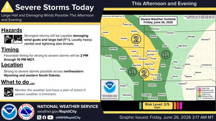
| There is a slight risk (2 out of 5) of severe thunderstorms from about 300 PM to 900 PM MT today (June 26, 2026) for northeastern Wyoming and far western South Dakota. The strongest storms will be capable of damaging wind gusts and large hail (1+”) with deadly lightning. Monitor the weather and have a plan of action if severe weather is imminent. |
Data Courtesy of RapidCity Weather Forecast Office