


| WEATHER STORY RapidCity Weather Forecast Office |

|
||
|
||
 |
||
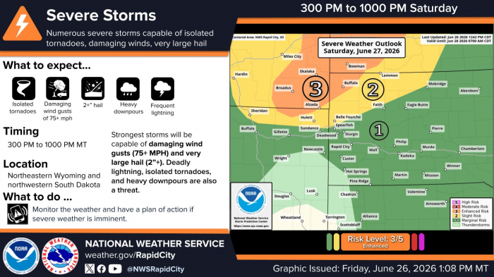
| There is an enhanced risk (3 out of 5) of severe thunderstorms from about 300 PM to 1000 PM MT Saturday (June 27, 2026) for northeastern Wyoming and northwestern South Dakota. The strongest storms will be capable of damaging wind gusts (75+ mph) and very large hail (2+”). Isolated tornadoes, heavy downpours, and deadly lightning are also a threat. The greatest threat area will be near the Wyoming, South Dakota, North Dakota border area. Monitor the weather and have a plan of action if severe weather is imminent. |
Data Courtesy of RapidCity Weather Forecast Office